Hurricane Milton to double in size as ‘storm of the century’ threatens Florida

By The Guardian - Edward Helmore - Wed 9 Oct 2024 15.18 BS
Category 5 storm expected to bring 15ft storm surge along coast affecting Tampa, St Petersburg and Sarasota
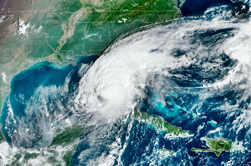
The category 5 Hurricane Milton is expected to double its wind field by the time it makes landfall in the US late Wednesday or early Thursday, with up to 15ft (4.5 metres) of storm surge along a low-lying stretch of the Florida coast that includes the cities of Tampa, St Petersburg and Sarasota.
Described as the “storm of a century”, with sustained winds still registering at 160mph (257km/h), Milton turned north-east overnight about 300 miles (480km) south-west of Tampa, aiming for heavily populated and highly vulnerable communities. It is expected to weaken slightly when it makes landfall to a category 4 with sustained wind speeds of about 130mph.
“Milton has the potential to be one of the most destructive hurricanes on record for west-central Florida,” the National Hurricane Center warned.

In an 8am update, the governor of Florida, Ron DeSantis, said it was not clear exactly where the eye of the storm would come ashore but the impact would be “broader than that … absolutely every place on the west coast of Florida could get major storm surge.”
“If you are in a single story home that is hit by a 15ft storm surge, which means that water comes in immediately, there’s nowhere to go,” said the mayor of Tampa, Jane Castor.
“So if you’re in it, basically that’s the coffin that you’re in.”
Authorities have issued mandatory evacuation orders across 11 Florida counties with a combined population of about 5.9 million people and said anyone choosing to stay behind must fend for themselves.
Before Helene hit, residents staying behind were encouraged to write their name and social security numbers on their bodies for easier postmortem identification.
Under current projections, the surge is expected to hit Fort Myers Beach, an area still recovering from Hurricane Ian two years ago that smashed a causeway to outlying islands.
The area was also hit by Hurricane Helene two weeks ago, raising concerns that discarded furniture, appliances and debris from that storm will become projectiles in this next one. DeSantis said the state deployed more than 300 dump trucks that had removed 1,300 loads of debris.
One resident said he had seen bull sharks swimming in the flooded streets after Helene.
No matter exactly where Milton comes ashore, the damage is expected to be extensive, with seawater funneling up through coastal channels inland. Cody Fritz at the US National Hurricane Center storm surge team told NBC News: “Florida’s west coast is very sensitive to storm surge. It doesn’t take much to push water over land that would be dry. It’s extremely vulnerable.”
Kara Doran, a US geological survey scientist, said the risk of permanent change to the coastline “cannot be overstated as I believe communities are more vulnerable to this storm’s impacts due to the erosion that occurred recently from Helene”.
Residents trying to leave have been faced with gas shortages and gridlocked roads. There are few hotels to shelter in and no flights out of the area. Ashley Khrais, a resident of Holiday, Florida, just inland from the coast, told NBC “it seems very, very scary, but there’s no way to leave.”
Mark Prompakdee, 71, a resident of a trailer park near St Petersburg, said he planned to sit the storm out in a minivan parked on higher ground at a high school. “They’re saying, ‘Get out of here,’” he said. “Where?”
But many people appeared to have heeded the warnings. “If there’s any good news here, we toured Fort Myers beach yesterday [and] it looks like people have listened to those warnings,” said Jay Gray of NBC News.
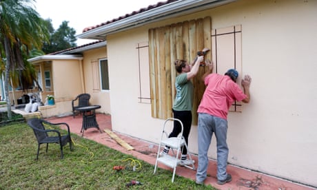
Efforts to protect property with sandbags and by boarding up windows had been done “with the knowledge that this could be the most powerful storm many in this area have ever seen, and they’ve seen plenty”, Gray said.
The National Weather Service warned that as Milton began moving onshore on Wednesday “conditions will be favorable for tornado development, even far away from the expected landfall”.
With area airports now closed, operators said they would not reopen until damage had been assessed. A spokesperson for Tampa international airport told Scripps News that safety was critical for their operations and it could not act as a shelter for travelers stuck there since it is located in an evacuation zone.
